I've never heard of this trail before! More: http://www.vispine.ca
It spans the entire length of the Island (over 700m of trails) from tip to tip.
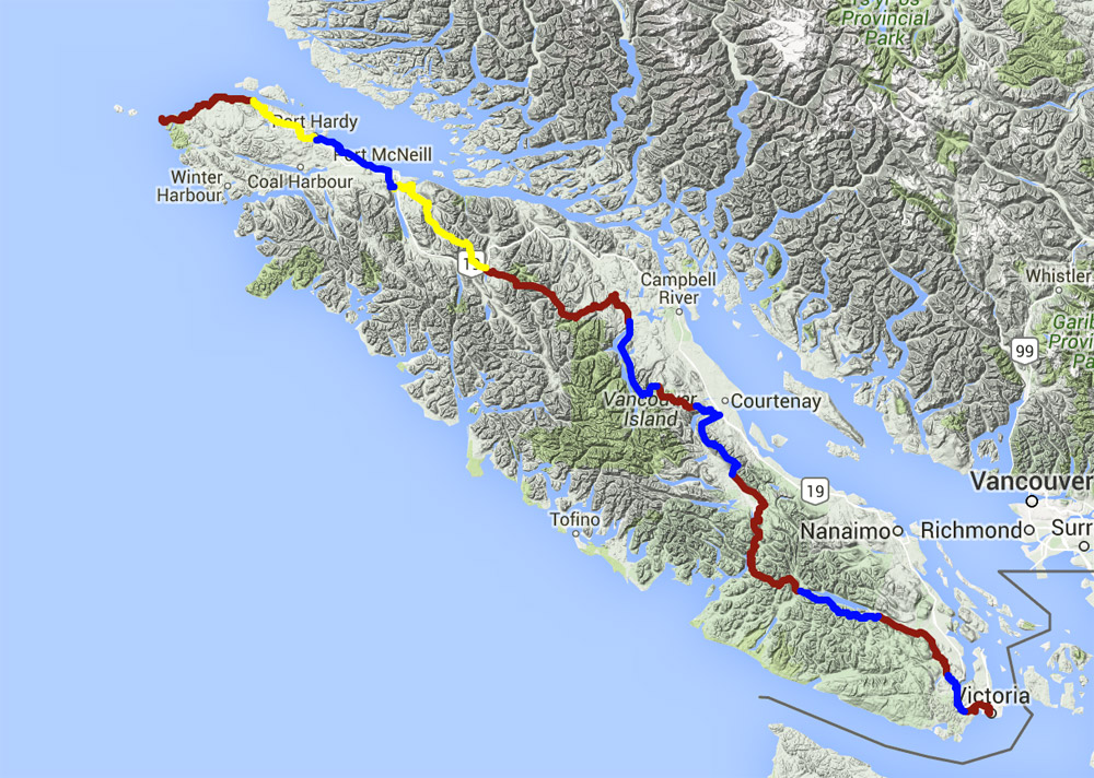
The Vancouver Island “Spine” Trail is a proposed trail from Victoria in the south to Cape Scott at the northern tip of the Island. The route is an inland path that passes near many communities, yet retains its wilderness character. It follows historic routes and uses some existing trails.
Approximately 700km long, the “Spine” is an adventure opportunity that will provide a recreational route for residents and tourists through the beautiful back country of Vancouver Island. Although it is primarily a hiking trail, some sections of the Spine are suitable for other non-motorized use, e.g. mountain bikes, horses, and skis. The route traces mountain ridges, passes through forests and alongside lakes, and is similar to other successful long-distance routes in North America.
The “Spine” Trail will support local economies through increased tourism, cultural tourism opportunities, trail building, and maintenance. Local First Nations, hiking clubs and other outdoor clubs will be encouraged to monitor the trail. First Nations and businesses will have an exciting new opportunity to provide services to travelers in their region.
The project is being developed by the Vancouver Island Spine Trail Association (VISTA), a part of “Hike BC”, the BC wing of the National Hiking Trail (NHT). Over the past 30 years the NHT has incorporated such significant trails as the East Coast Trail in Newfoundland, the Bruce Trail in Ontario, the Alexander MacKenzie route, and the Nuxalk/Carrier “Grease Trail” from Bella Coola to Quesnel.