It will run behind Songhees Wellness Centre and then up to Admirals Rd, joining the roadway right about where Thomas Rd is now.

[Bicycles] Regional Trails in Victoria: Galloping Goose, Lochside, Trans-Canada & E&N
Started by
Bingo
, Feb 19 2011 03:19 PM
1124 replies to this topic
#842

thundergun
-

- Member
- 1,172 posts
- LocationVictoria
Posted 17 March 2017 - 09:35 AM
There's been talk about this before, but it looks like it actually will get going soon:
Galloping Goose - Carey Road Connection
Start Date: March 2017
End Date: May 2017Project Description: The Galloping Goose Carey Road Connection Project is included in the 2017 Transportation Capital Budget and consists of construction of a 4.0m wide asphalt multi-use pathway at accessible grades, concrete staircase leading to existing stairs, a new concrete bus stop pad and an on-road southbound bike lane. Upgrades to the existing multi-use pathway, connecting Carey Rd and Galloping Goose Regional Trail were raised as part of the development process for the Uptown Shopping Centre. This pathway will improve walking and cycling conditions in the area by providing safe accessibility for all pathway users between Uptown, Carey Road and Galloping Goose.
The District of Saanich have been working with CRD Parks and Uptown (funding partners for this project) in developing a concept for multi-use pathway upgrade.
Project Status: The project is scheduled to be constructed in spring 2017 and will take approximately 5 weeks to complete, pending favorable weather conditions. Please see Concept Drawing [PDF - 3.4 MB]for the details.
#844
Bingo
-
- Member
- 16,666 posts
Posted 17 March 2017 - 02:54 PM
Uhh, this is exactly where the trail will be going:
Okay you are right about the trail going behind the Wellness Centre.
The point I was trying to make was having the trail next to the tracks from Maplebank west of the Wellness Cntre all the way to Hallowell Road, because if the Songhees don't want that to happen,
they will probably not want the train running through there as I mentioned in my previous posts.
#845
nagel
-
- Member
- 5,751 posts
Posted 17 March 2017 - 02:56 PM
Okay you are right about the trail going behind the Wellness Centre.
The point I was trying to make was having the trail next to the tracks from Maplebank west of the Wellness Cntre all the way to Hallowell Road, because if the Songhees don't want that to happen,
they will probably not want the train running through there as I mentioned in my previous posts.
I don't think they have the ability to stop the train using the tracks, but they did have the ability to stop the trail going right beside them.
#846
Coreyburger
-

- Member
- 2,864 posts
Posted 17 March 2017 - 02:56 PM
Okay you are right about the trail going behind the Wellness Centre.
The point I was trying to make was having the trail next to the tracks from Maplebank west of the Wellness Cntre all the way to Hallowell Road, because if the Songhees don't want that to happen,
they will probably not want the train running through there as I mentioned in my previous posts.
Two completely different First Nations (albeit quite intertwined). The concern about running along the tracks from Esquimalt Nation, who quite rightly don't want the trail running past their longhouse. The Songhees Wellness Centre is for Songhees Nation.
#847
Bingo
-
- Member
- 16,666 posts
Posted 17 March 2017 - 03:18 PM
The concern about running along the tracks from Esquimalt Nation, who quite rightly don't want the trail running past their longhouse.
I don't think they have the ability to stop the train using the tracks, but they did have the ability to stop the trail going right beside them.
The Esquimalt Nation chief Andy Thomas is watching the outcome of the Nanoose Bay First Nation’s claim.
Thomas said he will watch the Nanoose Bay First Nation’s claim against the Island Corridor Foundation closely.
The Snaw-Naw-As filed a B.C. Supreme Court claim against the Island Corridor Foundation and the Attorney General in December.
It’s asking for the return of land that was taken as part of the controversial E&N land grants in the last century.
If successful, it could create a fatal gap in the 289-kilometre corridor between Victoria and Courtenay.
- See more at: http://www.timescolo...7.11Ym06iJ.dpuf
#848
Bingo
-
- Member
- 16,666 posts
Posted 10 May 2017 - 02:16 PM
The CRD Board awarded a contract to Don Mann Excavating Ltd for $783,960 for work on the segment of the project between Maplebank Road and the Songhees Nation boundary.
This contract includes safety improvements at the railroad crossing at Maplebank. The CRD Board also approved a $421,310 contract to Southern Railway of Vancouver Island for the purchase, installation and commissioning of safety equipment for the railroad crossing safety improvements. The safety improvements at the rail crossings will meet new Canadian RailwayRoadway Grade Crossings Standards adopted by Transport Canada.
The trail alignment along Admirals Road will be constructed by the Ministry of Transportation and Infrastructure this summer during its scheduled roadway upgrade.
The final link along Hallowell Road is under design and is scheduled for completion by late 2017.
#849
Mike K.
-

- Administrator
-

- 83,469 posts
Posted 10 May 2017 - 02:36 PM
Oh geez, that's such a massive sum of money so very likely spent for nothing.
- 57WestHills likes this
Know it all.
Citified.ca is Victoria's most comprehensive research resource for new-build homes and commercial spaces.
#850
Gary H
-

- Member
- 3,482 posts
Posted 23 May 2017 - 09:01 PM
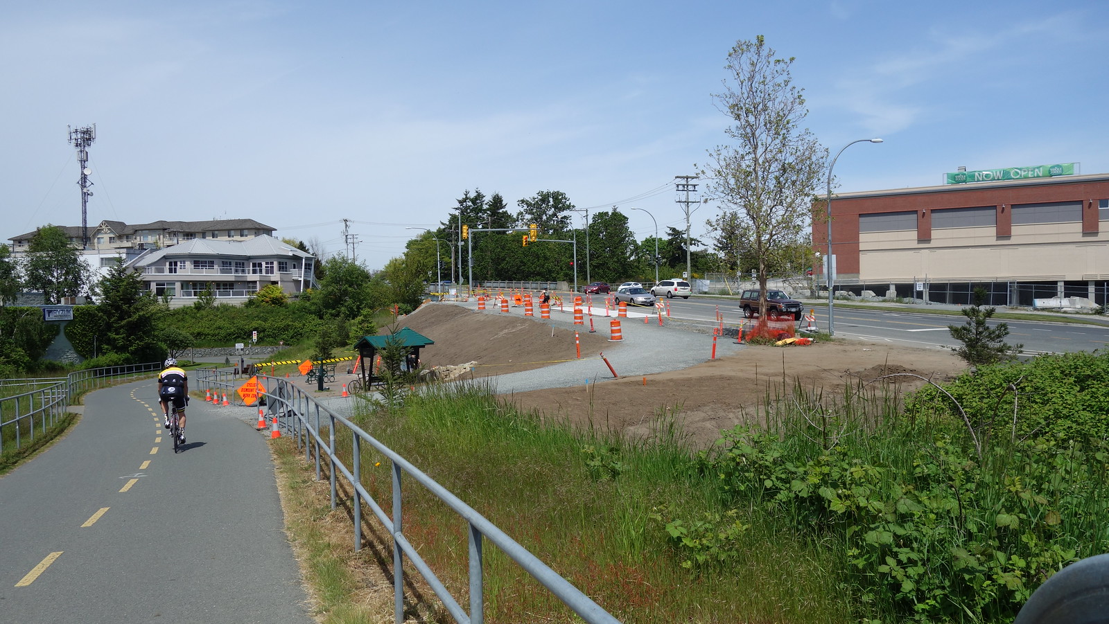
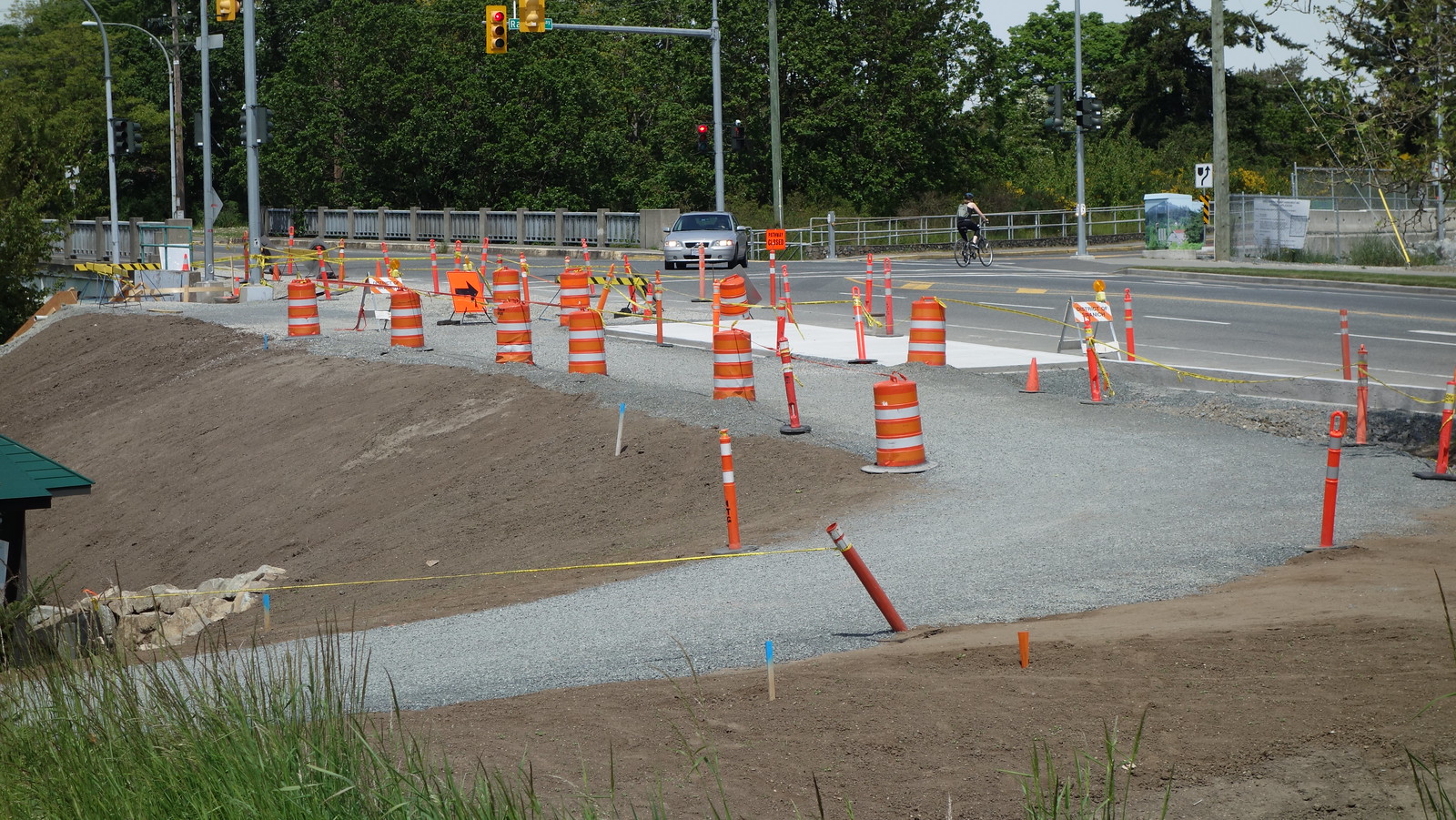
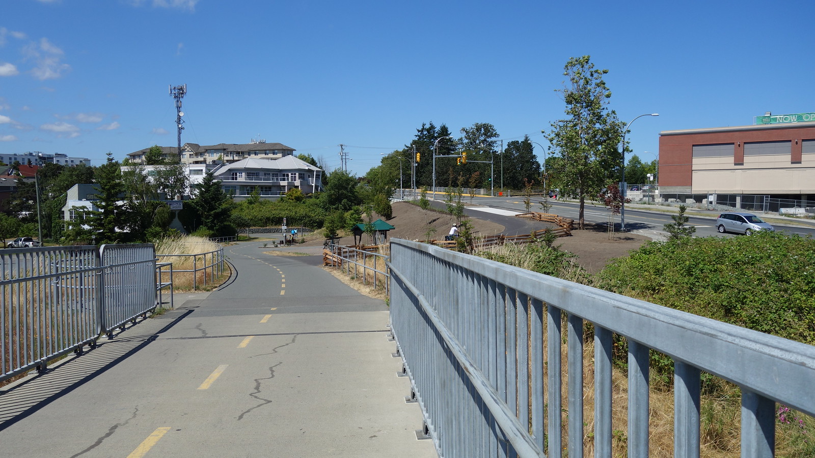
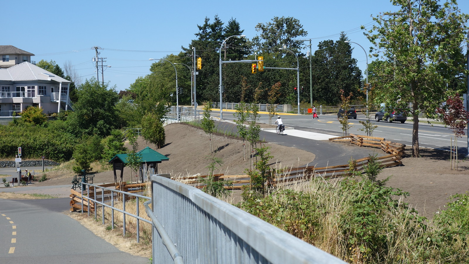
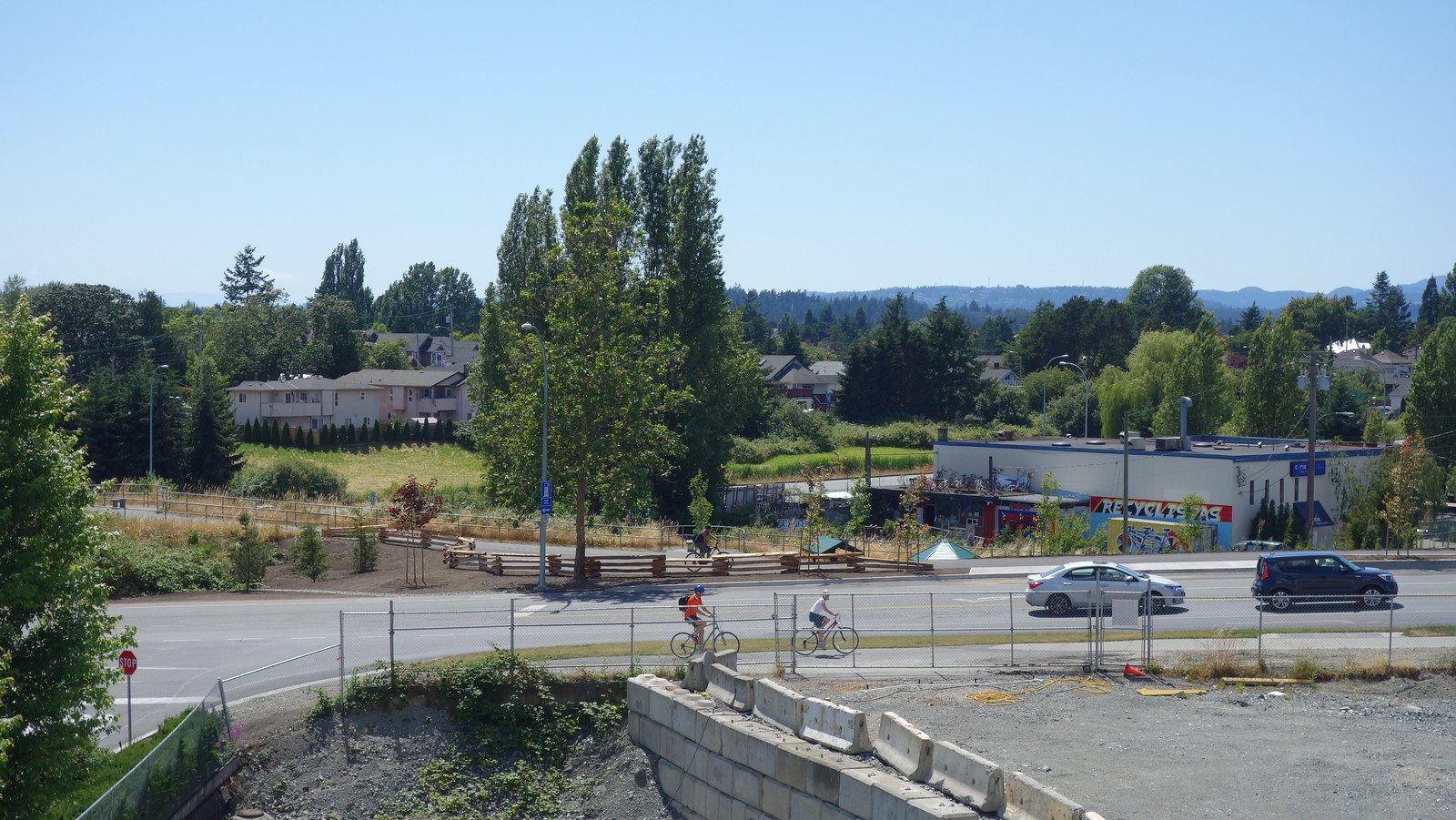
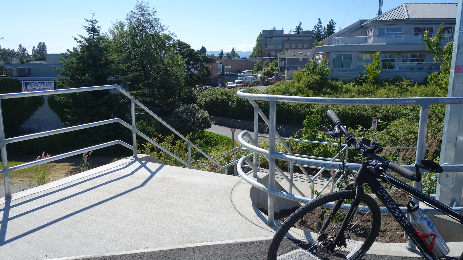
Some good progress...
They're allowing cyclists to use the access the ramp if they dismount. Problem with that is gravel is making its way onto the existing path - not so good. The new ramp is great for access to Whole Foods and the rest of Uptown. But they need to remove more of the railing on the south side, which I think they'll do if you look at the last pic. If they just pave it the way it is then that hard right turn onto the ramp, on a downhill slope no less, will cause all kinds of problems. Bikes will have to slow way down to make the turn causing issues for those accelerating downhill to continue north. I saw a bunch of cyclists just stopped in front of the ramp, like they weren't sure if they could use it, pretty much blocking the entire Goose path. The downhill access to this ramp needs to be wider so cyclists can make a smooth transition to the ramp without having to come to a near stop. Removing the railing to the orange ribbon in the last pic would probably be just right. Looks like they've got gravel going there too.
Edited by Gary H, 23 May 2017 - 09:02 PM.
#851
thundergun
-
- Member
- 1,172 posts
- LocationVictoria
Posted 31 May 2017 - 03:28 PM
Not much of a story, but it looks like they're taking down this gazebo (with the red roof) on the west side of the Selkirk trestle. They took off the roof panels yesterday and this morning they appeared to be cutting through the roof truss. Not sure if anyone has more info.
https://goo.gl/maps/bcVHqaT2Htk
#852
Mike K.
-
- Administrator
-
- 83,469 posts
Posted 31 May 2017 - 04:53 PM
Hmm. I wonder if it became a magnet for campers?
Know it all.
Citified.ca is Victoria's most comprehensive research resource for new-build homes and commercial spaces.
#853
Bingo
-
- Member
- 16,666 posts
Posted 31 May 2017 - 06:56 PM
Not much of a story, but it looks like they're taking down this gazebo (with the red roof) on the west side of the Selkirk trestle.
They took off the roof panels yesterday and this morning they appeared to be cutting through the roof truss. Not sure if anyone has more info.
It's a story if you happened to be one of the folks who purchased a plaque in memory of a loved one.
http://trailsbc.ca/t...ns-canada-trail
About the Pavilions
The Trans Canada Trail's presence is felt not just by trail but by its well-known red roofed pavilions, which can be found across the country and are a way of thanking those who have donated funds to the completion of this project. Within BC, over 31,356 individual names and 900 messages are enscribed on the pavilion panels. We thank all the Trans Canada Trail supporters and proud Canadians that have submitted these names and messages.
In BC there are completed pavilions in:
- Victoria
- Nanaimo
- North Vancouver
- Vancouver (Granville Island)
- Burnaby
- Pitt Meadows
- Maple Ridge
- Coquitlam
- Fort Langley
- Abbotsford
- Chilliwack
- Hope
- Penticton
- Grand Forks
- Trail
- Cranbrook
- Fernie
The dominance of pavilions in the lower mainland is due to local community support. Most are smaller pavilions and financed by the community.
For more information about the Trans Canada Trail, please visit their web site: www.tctrail.ca
#854
Coreyburger
-
- Member
- 2,864 posts
Posted 01 June 2017 - 04:55 PM
I spoke with the people taking the gazebo down - it is being repaired and replaced with a different roof, etc. I would guess for the 150 celebrations and the "completion" of the TCT.
- Bingo and thundergun like this
#855
thundergun
-
- Member
- 1,172 posts
- LocationVictoria
Posted 02 June 2017 - 08:38 AM
^Thanks for that. Noticed some new paint there this morning.
And lol re: completion. Let's not let facts get in the way of a Canada 150 celebration.
- Coreyburger likes this
#856
Gary H
-
- Member
- 3,482 posts
Posted 03 July 2017 - 08:20 PM
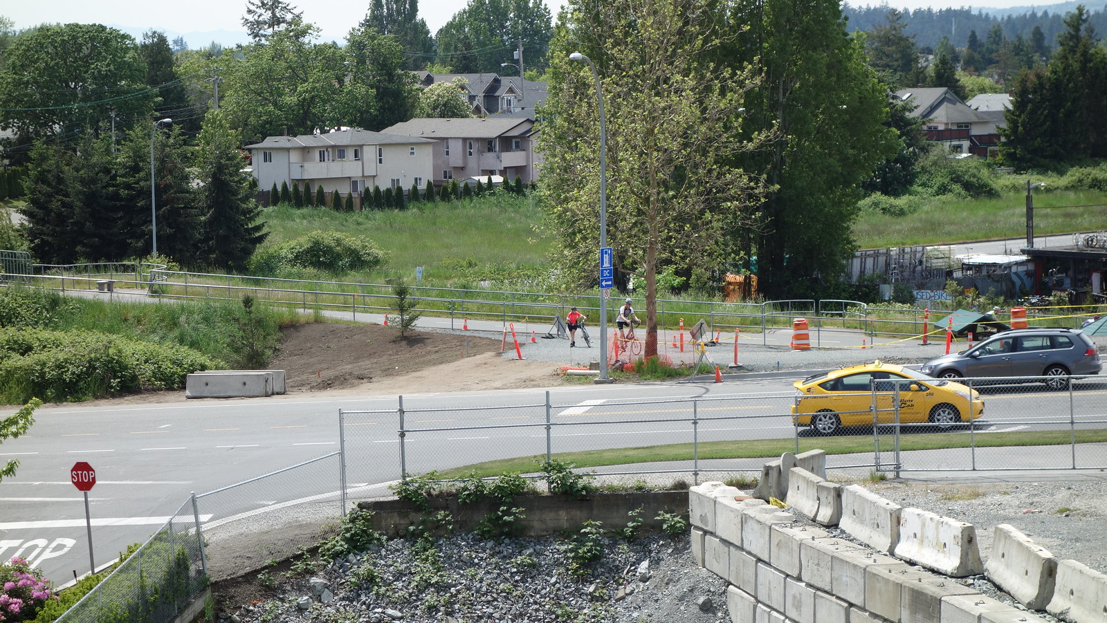
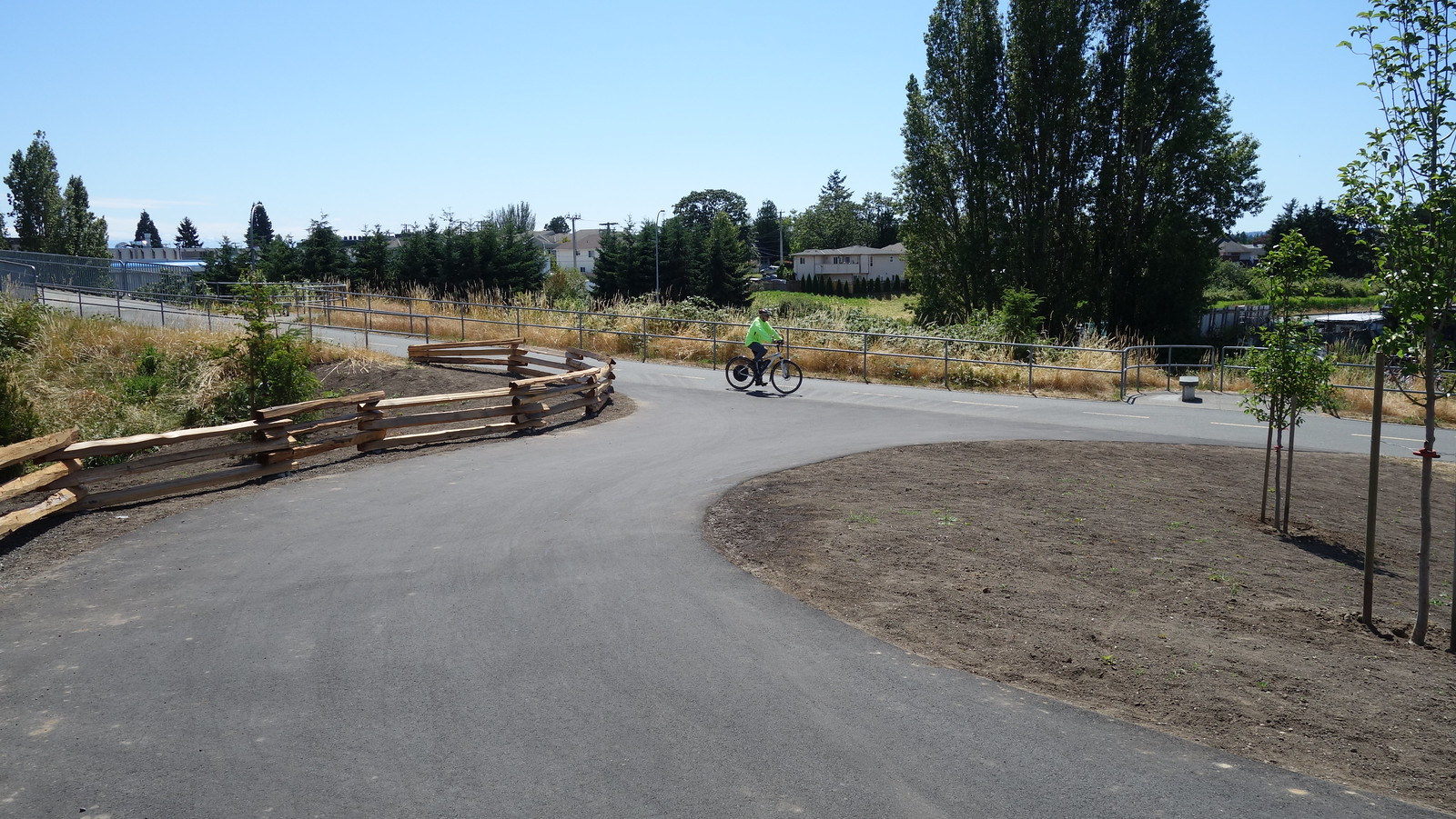
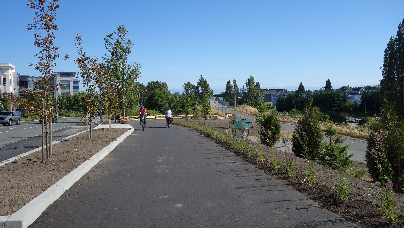
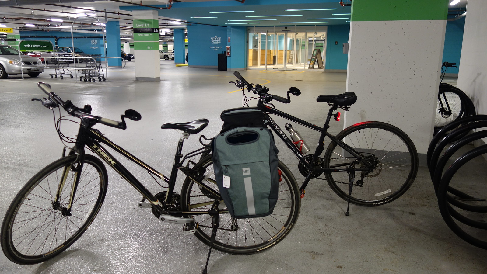
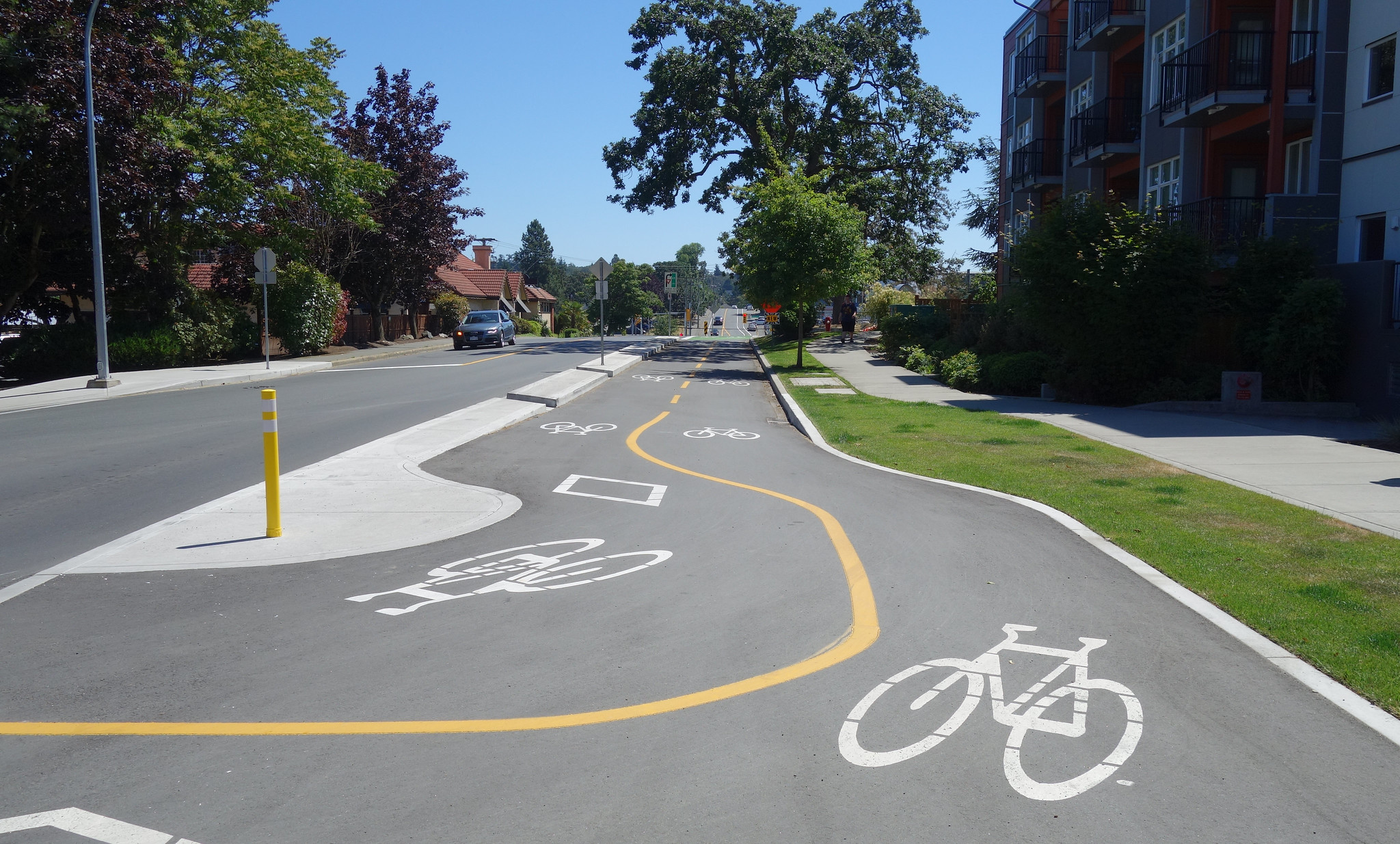
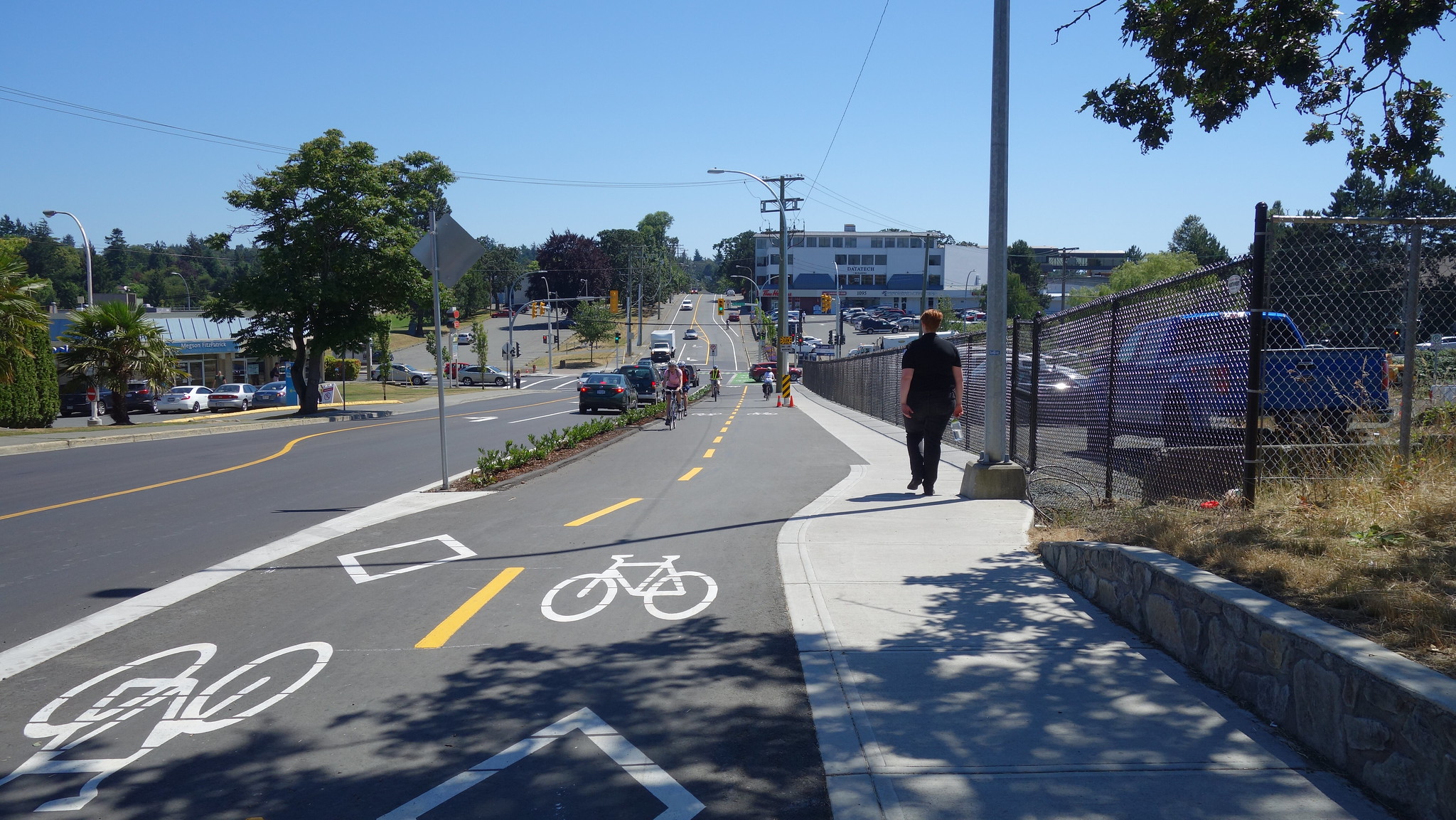
New Uptown Connector is Complete... 
Nice job on this one. My worries for a tight turn have been laid to rest. The wooden fence is a nice detail. We biked to Whole Foods, entered the parking structure from Ravine Way and locked our bikes at the Whole Foods entrance. That new MEC panier is great for carrying boxes of Whole Foods take out.
Edited by Gary H, 03 July 2017 - 08:21 PM.
- rjag, lanforod and shoeflack like this
#857
Greg
-

- Member
- 3,362 posts
Posted 04 July 2017 - 05:01 PM
I tried it out last week for Whole Foods trip, and liked it, but failed on the "entered the parking structure from Ravine Way and locked our bikes at the Whole Foods entrance" part. Not sure where I went wrong. What did you do after you crossed with the light and got onto Ravine Way?
#858
Gary H
-
- Member
- 3,482 posts
Posted 04 July 2017 - 05:33 PM
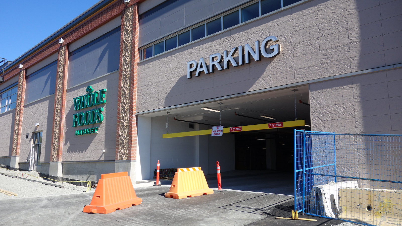
Enter the parkade off Ravine Way (to your right), turn left and go back as far as you can go. You're now under the back of Whole Foods so you need to jog a bit to the right to be under the entrance - can't miss it. If you look closely in the above pic you'll see a yellow sign that says Ravine Way ->, so the parkade entrance pictured below is in the upper left of the pic above.
Edited by Gary H, 04 July 2017 - 05:58 PM.
- 57WestHills likes this
#860
Gary H
-
- Member
- 3,482 posts
Posted 07 July 2017 - 11:08 AM
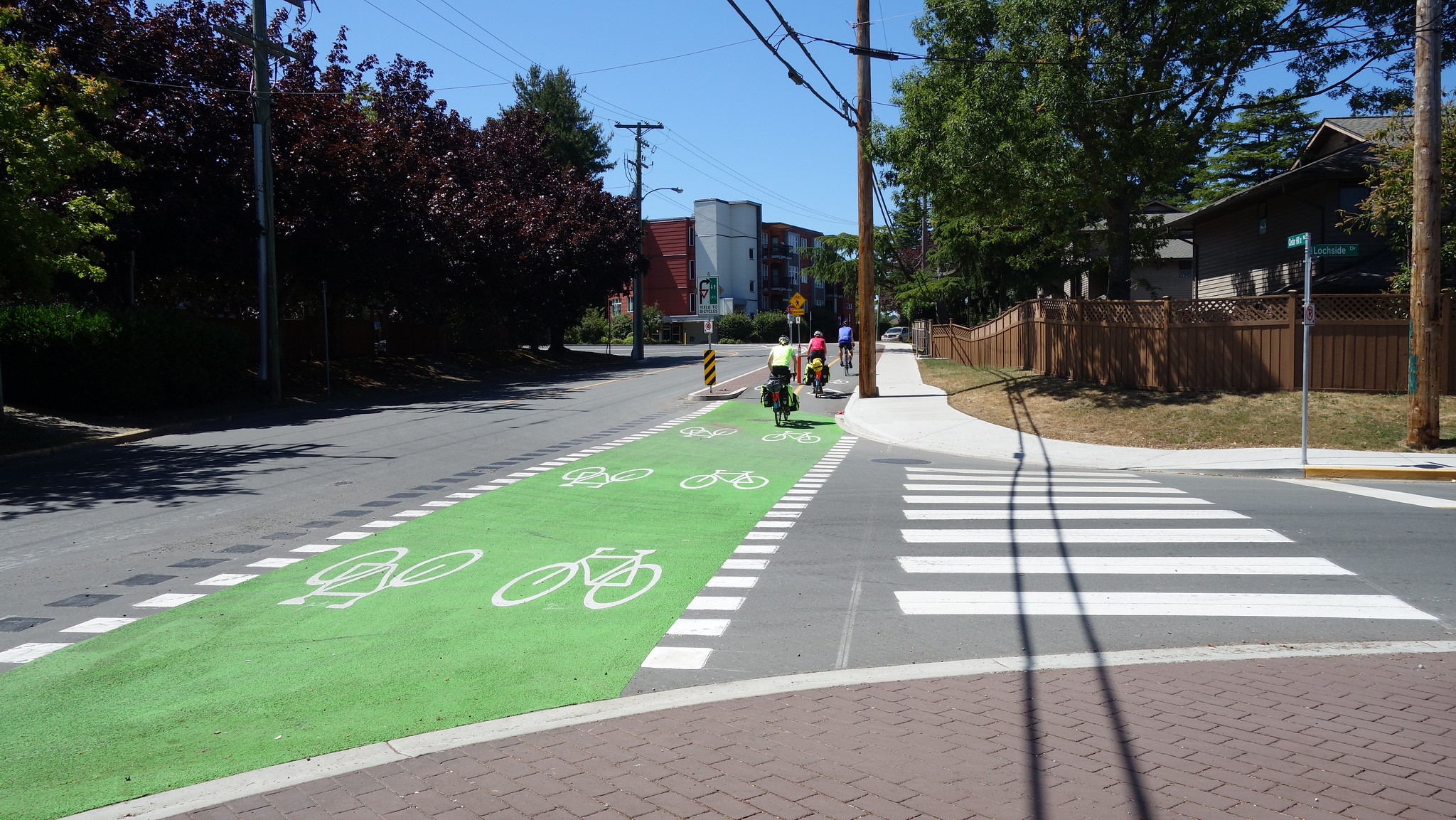
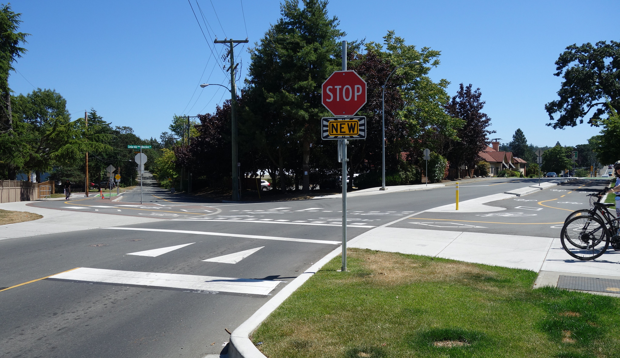
The McKenzie - Borden dedicated bike lanes...
As was pointed out in the other bike thread, the dedicated bike lanes through this section are now complete. Rode through here the other day, it's really sweet. Cyclists have no stops once they enter the new path but should be cautious at the entrance to the public works yard.
Just wanted to add some pics to show the changes. I'm also including the pic from the other thread.

Edited by Gary H, 07 July 2017 - 11:26 AM.
- Greg and Kungsberg like this
You're not quite at the end of this discussion topic!
Use the page links at the lower-left to go to the next page to read additional posts.
Use the page links at the lower-left to go to the next page to read additional posts.


0 user(s) are reading this topic
0 members, 0 guests, 0 anonymous users

