Thanks for that, rambaldi.
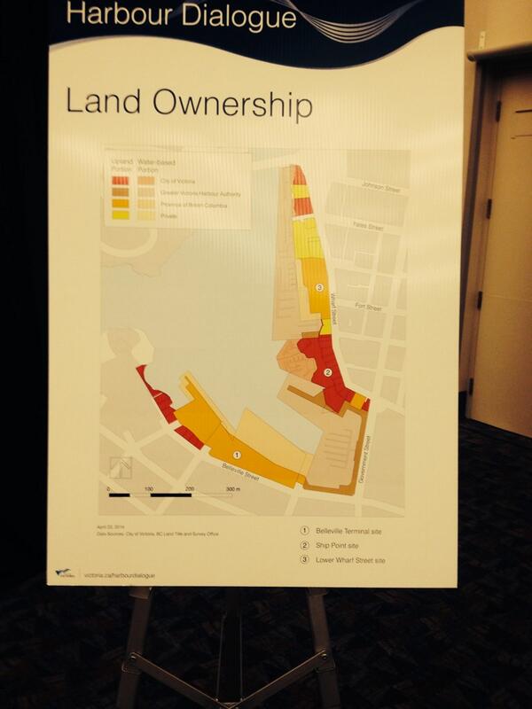
Would you be able to note the owners of the corresponding colours? It's a little hard to see.
I went to the Saturday session.
What makes the map confusing is that it's divided into land and sea ownership so anything underwater or built on water (like docks) is likely owned by a different authority than what the dock's connected to.
Looking at the three large images of the sites you tend to think of them in isolation--they might as well be on separate continents. But if you look at the area from above (Bing Bird's Eye is the best for this) then it's clear that Ship Point and the Reid Site are really one long strip interrupted by the Malahat Building/Red Fish Blue Fish.
Listen, I've been to more of these workshop things than I dare admit, and like most cases, many of the people at the morning session represented some special interest group of one form or another. Nothing wrong with that but it can limit discussion about broader topics and big issues.
The City desperately wants to hear some dynamic, visionary brainstorming from its citizens and instead people are saying it's fine as long as I can keep my kayak pathway or yacht race registration table or there should be a bench or a waterfountain or what have you.
What I'm saying is, the City really wants to hear what you have to say. If you're on this forum, you're the kind of person that needs to speak up.