Jump to content


Photo

Nitinat Lake?


  • Please log in to reply
12 replies to this topic

#1 AllseeingEye

AllseeingEye

    AllSeeingEye

  • Member
  • 6,601 posts

Posted 30 June 2016 - 09:38 AM

Probably heading out tomorrow or Saturday morning to join some lads camping/fishing at Nitinat Lake; while I've been from the sea approaches in a boat I've never actually driven there from the east side of the island.


Heading overland from Duncan and just wondering if any VV poster has been on the logging road past Youbou recently? If so what condition was it in and more importantly is there decent (or any) signage keeping you on the path to the village and ultimately to the lake? I know there are several T-intersections along the way and one wrong turn and you're pooched heading off into the wild blue yonder....


Thanks

ASE


#2 Mike K.

Mike K.
  • Administrator
  • 83,548 posts

Posted 30 June 2016 - 10:19 AM

I go there regularly. Haven't been recently but you never know with that road, so just expect lots of potholes. Generally, though, at this time of year the road has been serviced and isn't so bad but there have been periods in the summer where road conditions were poor.


Stick to the main road and you'll be fine. There are lots of turnoffs but you can figure out very easily which is the bigger, more traveled route. There are some signs but not at every t- or y-, but like I said you'll be fine. Then once you get to the main t- that takes you to the lake there is a large sign indicating that you need to turn left for the village.


Have fun out there, it's paradise out that way!


Know it all.
Citified.ca is Victoria's most comprehensive research resource for new-build homes and commercial spaces.


#3 AllseeingEye

AllseeingEye

    AllSeeingEye

  • Member
  • 6,601 posts

Posted 30 June 2016 - 10:27 AM

I go there regularly. Haven't been recently but you never know with that road, so just expect lots of potholes. Generally, though, at this time of year the road has been serviced and isn't so bad but there have been periods in the summer where road conditions were poor.


Stick to the main road and you'll be fine. There are lots of turnoffs but you can figure out very easily which is the bigger, more traveled route. There are some signs but not at every t- or y-, but like I said you'll be fine. Then once you get to the main t- that takes you to the lake there is a large sign indicating that you need to turn left for the village.


Have fun out there, it's paradise out that way!

Thanks Mike; also got hold of a PDF floating around on the web that provided good directions and was fairly instructive - used lots of small words and big pictures...IOW perfect for me :). Yes its great country, I've been there before from the sea-side entrance. Looking forward potentially to some awesome fishing.


#4 Gary H

Gary H
  • Member
  • 3,482 posts

Posted 30 June 2016 - 10:30 AM

...and more importantly is there decent (or any) signage keeping you on the path to the village and ultimately to the lake? I know there are several T-intersections along the way and one wrong turn and you're pooched heading off into the wild blue yonder....


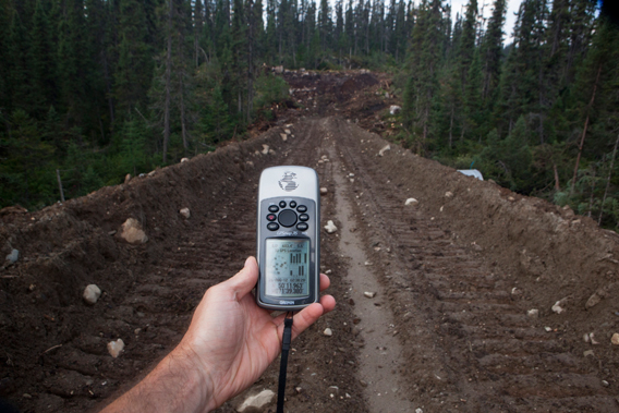
^^^ That's what GPS is for.   :)


Evidence-5.greenpeace.roaddestruction.56


However, as this "older" couple found out, it's not always full-proof.  They blindly trusted their GPS's recommended route that took them onto logging roads and they got stuck and had to be rescued.   :whyme:


From: https://kobi5.com/ne...ing-road-13537/

10.02%20P2-NEWS-REVIEW--gps-leads-califo


Edited by Gary H, 30 June 2016 - 10:41 AM.


#5 Mike K.

Mike K.
  • Administrator
  • 83,548 posts

Posted 30 June 2016 - 10:54 AM

You'll be fine, ASE. That road is very well travelled and if you do find yourself heading up the wrong way you can always back up and flag down a passing vehicle.


Here are a couple of tips:

- once you pass Youbou, you will drive for some distance along a section of road flanked by houses and cottages. Once you pass them you'll continue on until you get to the end of the lake. You can't miss it, it'll be on the left (note: along some parts of this stretch you go inland a bit, which gives the impression you've passed the lake but you haven't and will veer to its banks soon afterwards).


- at the end of the lake you'll see the road continuing west (STRAIGHT) and an option to turn left. Keep going straight unless you want to double back to Lake Cowichan along the SOUTH road (Youbou is along the NORTH road).


- you'll pass Kissinger Lake campground on your LEFT


- there will be several signs pointing towards CARMANAH. Stick with those signs if/when you see them, that's the direction of the Ditidaht Village (at Nitinaht Lake).


- rule of thumb is if you're on a road that is on an incline or a decline, you've gone off the logging main and should re-assess. You'll likely be traveling at between 40 and 60, which should take approximately 40 minutes to arrive at the Ditidaht junction where you'll want to turn LEFT to head to the village and the lake. You'll know when you get there. If you end up turning RIGHT for whatever reason, you'll end up on a large bridge crossing the Nitinaht River. At that point you'll want to turn around and head in the opposite direction. From the T it's about 8km to the village.


Hope this helps :)


  • AllseeingEye likes this

Know it all.
Citified.ca is Victoria's most comprehensive research resource for new-build homes and commercial spaces.


#6 Bernard

Bernard
  • Member
  • 5,056 posts
  • LocationVictoria BC

Posted 30 June 2016 - 12:43 PM

The road is a good road and there are signs showing the way to a number of important locations along the way 


Follow Cowichan Main to Carmanah Main - you will skirt past the community of Dididaht at the head of Nitnat lake.  Change to Rosander Main, which is just over a river once you have past Ditidaht.   15 km along Rossander there is junction with a road I do not know the name of - this is the best road to access the shore of Nitnat.  There is a boat launch there and a campsite


This is in my opinion the best location to access the lake


#7 AllseeingEye

AllseeingEye

    AllSeeingEye

  • Member
  • 6,601 posts

Posted 06 July 2016 - 08:03 AM

Good instructions thanks gents; got there just fine. As expected due to dry conditions the road had some good "man-sized" pot holes but otherwise was fine. The one-lane bridges can be an adventure if you're not paying attention. Due to a large wind surfing competition at Nitinat itself we actually deferred and went further into the bush and fished Kissinger Lake, remote but a fantastic spot for belly boating/fly fishing.


Edited by AllseeingEye, 06 July 2016 - 09:11 AM.


#8 Mike K.

Mike K.
  • Administrator
  • 83,548 posts

Posted 06 July 2016 - 08:42 AM

How was Kissinger Lake? Did you take the main to get there or did you find a different route to the lake?


Know it all.
Citified.ca is Victoria's most comprehensive research resource for new-build homes and commercial spaces.


#9 AllseeingEye

AllseeingEye

    AllSeeingEye

  • Member
  • 6,601 posts

Posted 06 July 2016 - 09:19 AM

How was Kissinger Lake? Did you take the main to get there or did you find a different route to the lake?

"Both"; we started on down the main road then more of less made our own path through the bush :) to a secluded part of the lake. Doesn't always work of course as you can encounter impassable terrain on occasion. When fishing back country areas we find this generally works well in order to access the more remote areas of a watershed; we do this frequently on the Cowichan and Squamish River systems and also to great effect on a trip to the Rockies a few years ago when camped out on the Athabasca River. We were aware generally of a nearby lake but didn't have a map so based on instructions from a local fisherman we literally boonie-bashed in the SUV until we got to a trail within 500 meters of the lake. The 4 of us wound up having an entire river-lake ecosystem to ourselves which makes the effort worthwhile...


You do have to be aware of certain caveats though; on the Squamish for example you need explicit permission from the band to fish their traditional river-watershed.


#10 Mike K.

Mike K.
  • Administrator
  • 83,548 posts

Posted 06 July 2016 - 09:35 AM

Good stuff. There's so much to explore on the south Island if you're willing to boonie bash through the bush.


Glad to hear you had a good time out there :)


  • AllseeingEye likes this

Know it all.
Citified.ca is Victoria's most comprehensive research resource for new-build homes and commercial spaces.


#11 AllseeingEye

AllseeingEye

    AllSeeingEye

  • Member
  • 6,601 posts

Posted 01 November 2016 - 07:08 PM

Speaking of the Nitinat Lake area, we took the opportunity last week on the one nice day we had to head out fishing, open up the throttle close on 30kts and scoot on up in that direction and beyond towards Bamfield....


Attached Images

  • Kuroshio.jpg

  • Bingo likes this

#12 Mike K.

Mike K.
  • Administrator
  • 83,548 posts

Posted 02 November 2016 - 10:25 AM

Very cool.

I'm guessing that thing isn't powered by a 9.9?
  • VicHockeyFan likes this

Know it all.
Citified.ca is Victoria's most comprehensive research resource for new-build homes and commercial spaces.


#13 AllseeingEye

AllseeingEye

    AllSeeingEye

  • Member
  • 6,601 posts

Posted 03 November 2016 - 03:57 PM

Very cool.

I'm guessing that thing isn't powered by a 9.9?

Er....no, quite right :). As of 2012 the boat, which is actually a commercial diving rig, has been powered by an inboard 12-cylinder Volvo TAMD 63P with a twin disk 5061 Marine Transmission. Top speed is ~ 29 knots weight @ 16,000 pounds. 'Cruising speed' is about 25 knots.


Here is a pic of the wheelhouse circa 2014....

Attached Images

  • Kuroshio wheelhouse.jpg


0 user(s) are reading this topic

0 members, 0 guests, 0 anonymous users