I use my phone on lunches and breaks.
Edited by sdwright.vic, 12 January 2019 - 10:37 AM.

Colwood

Posted 12 January 2019 - 10:36 AM
Edited by sdwright.vic, 12 January 2019 - 10:37 AM.
Colwood
Posted 12 January 2019 - 10:38 AM

Posted 12 January 2019 - 06:19 PM
The area we're talking about is far larger than anything that could be described as a "buffer zone", it's close to the entire Southern tip of the Island.
Not to be disagreeable, but the watershed certainly does "start" and "end". Each one of our three watersheds have specific and designated boundaries. The Sooke watershed is in a "bowl" surrounded by mountains on all sides. The water in that "bowl" goes nowhere else but into that bowl (Sooke Lake).
The potential Malahat emergency bypass would be entirely outside of that bowl, and is therefore entirely outside the physical watershed.
The CRD Water Commision isn't trying to protect any of the streams or rivers going into Sooke Lake ("the bowl), they're trying to prevent anybody from getting anywhere near the outside of that bowl.
The proposed Malahat bypass would be 8 to 10 miles away from the outside of the bowl, more like 12 to 14 miles away from Sooke Lake itself.
The potential emergency bypass is closer to the Goldstream Watershed, but seeing as we don't use that water for but one week each year ... it's dubious whether such over the top protection is required (note that even the proximity to the Goldstream Watershed is measured in miles, in this case about 3 or 4 miles away).
Going to Sooke Lake on Google Maps and clicking "3D" makes things pretty clear. The potential Malahat bypass, although inside the designated watershed, is nowhere near the actual water.
Except all the access points of potential bypass routes show them bisecting Goldstream Park. Unless they can have an access point that doesn't bisect the park. Let's hope the NDP isnt stupid in that regard to allowing the park becoming damaged.

Posted 12 January 2019 - 06:59 PM
So change the boundaries of the park, been done before and will be done again.

Posted 13 January 2019 - 07:54 AM
Know it all.
Citified.ca is Victoria's most comprehensive research resource for new-build homes and commercial spaces.

Posted 13 January 2019 - 08:42 AM
So change the boundaries of the park, been done before and will be done again.
Except all the access points of potential bypass routes show them bisecting Goldstream Park. Unless they can have an access point that doesn't bisect the park. Let's hope the NDP isnt stupid in that regard to allowing the park becoming damaged.
I'm not following you at all.
The current highway runs right through the middle of Goldstream Park for over two miles?
Old White Man On A Canadian Island
Posted 13 January 2019 - 08:44 AM
Edited by Victoria Watcher, 13 January 2019 - 08:45 AM.
GET OFF MY LAWN

Posted 14 January 2019 - 10:55 AM
So I heard about this road (Goldstream Heights) that currently runs parallel to the Malahat from the south Shawnigan Lake Road southward towards Victoria. Mike K talked about it on his Friday CFAX Roundtable show.
This road runs down to the about the southerly power lines that cross the Saanich inlet just north of Goldstream Park. If this road were extended further and connect with the #1, it could act as a bypass to the Malahat if the Malahat was closed for any reason. Seems like a no brainer doesn't it? I think it would be possible to drive from Goldstream Park... past Shawnigan Lake....all the way to Mill Bay if it were extended.
This first link will take you to a google map that should give you an idea of what we are talking about.
https://www.google.c...t/data=!3m1!1e3
This second link should give you an idea of what driving this road is like....and yes I am holding my iPhone while I am driving. It was a lovely day yesterday. I couldn't resist breaking the law to get the shot. Get over it.  I am travelling from south to north.
https://drive.google...0aYP-3GbYsCbYqz

Posted 14 January 2019 - 11:16 AM
Malahat is clear for traffic now.
Banff put an entire town in the middle of a park.
Technically, Canada put an entire park around Banff. Alberta did put an entire 4-lane highway with median and wildlife crossings through the park, though. BC has been twinning the TCH through Glacier and Yoho NPs.
Posted 14 January 2019 - 11:18 AM
Goldstream Heights eh?
Who knew?
(sigh)
Posted 14 January 2019 - 03:39 PM
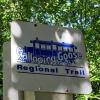
Recreational cyclists knew about the Niagara Main, that is who knew. The Great Trail, formerly Trans-Canada Trail, connects the Goldstream Heights with the Niagara Main, which is in the Sooke Hills Reserve. The GT southwest of the Goldstream Heights runs along the Niagara Main almost to the Humpback Reservoir. This former logging road is actually in decent condition and the CRD built a nice washroom half way between the Humpback Reservoir and the gate on the Niagara Main where the trail diverts off the Niagara Main onto the recently logged area just south of the Heights.Goldstream Heights eh?
Who knew?
(sigh)
Edited by splashflash, 14 January 2019 - 04:24 PM.
Posted 14 January 2019 - 05:26 PM
You don't say?
Who knew?

Posted 14 January 2019 - 08:07 PM
You don't say?
Who knew?
Turns out it was recreational cyclists. Not all recreational cyclists though - I didn't know.
Posted 14 January 2019 - 09:36 PM
Turns out it was recreational cyclists. Not all recreational cyclists though - I didn't know.
GET OFF MY LAWN
Posted 16 January 2019 - 07:09 AM
I don't know why I have trouble warming up to this politician. Whenever I see her on the news she seems a little disorganized. She appears to be well liked in the north of the island...but I don't know...something's off.
https://vancouversun...simply-buy-time

Posted 16 January 2019 - 07:31 AM
^
Eighteen months into their term of office, the New Democrats have already assembled an ambitious list of commitments to build schools, hospitals, transit, bridges, roads and other projects. No offence intended to the capital region or the south Island. But the New Democrats need ways to delay promise-making on the capital side, lest all the borrowing undercut the provincial credit rating.
Doesn't seem to matter what government gets in. Others will always get funds at the expense of those living in the CRD.
Posted 16 January 2019 - 07:59 AM
Know it all.
Citified.ca is Victoria's most comprehensive research resource for new-build homes and commercial spaces.
Posted 16 January 2019 - 08:52 AM
Let's just face it.
The Malahat, is the Malahat, is the Malahat. It's all we've got, and it's all we'll ever have.
The ridiculous concept of using the Pacific Marine Route as an emergency by-pass will be foisted once again (by the NDP this time) as a miraculous solution to the problem ... while anybody who's ever driven the Marine Route knows that it's nothing of the sort.
There are no emergency rescue services immediately available for the Pacific Marine Route, nor are their any emergency rescue services for the existing homes (and therefore cars) up on Goldstream Heights.
The Pacific Marine Route can pile up a couple of feet of snow quite easily, and more than one poor driver has been trapped up there for days, and had to await rescue.
The politicians at every level put forward that they are totally in support of a solution to the "Malahat Problem", but the Province has no funds to build anything, and the CRD won't let anybody build anything in the Watershed or the Reserve.
What you're looking at today is exactly the same as what you'll be looking at 50 - 100 years from now ... or until there's a hover-car in every driveway.

Posted 16 January 2019 - 08:59 AM
...What you're looking at today is exactly the same as what you'll be looking at 50 - 100 years from now ...
Sad, but true. 


0 members, 0 guests, 0 anonymous users

Community Forum Software by IP.Board 3.4.6
Licensed to: Citified Media Inc. All materials © Copyright Citified Media Inc. All rights reserved.


