Jump to content


Photo

Water Transit


  • Please log in to reply
30 replies to this topic

#1 Caramia

Caramia
  • Member
  • 3,835 posts

Posted 17 March 2007 - 11:22 PM

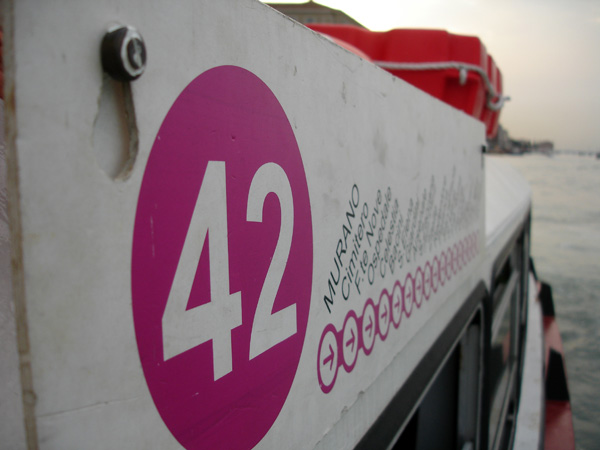
What I would I'd be interested in, is if BC transit got in the water - for local trips within greater Victoria. Around the Gorge, Esquimalt, Colwood..


I totally agree! You look at a map or aerial picture of Victoria and see almost a complete ring of lakes, gorge and harbour. Overland transit has to go around all this water when really they could go along it. This beautiful shot by bcradio illustrates it nicely, as well as the shot valleyflyfisher posted from Randall and Kat's Flying Photos! What if we worked with our geography instead of working around it? We could create a world class commuter network, something people looked forward to in the morning!

bcradio.. wow!


Randall and Kat - we are wrapped around water.
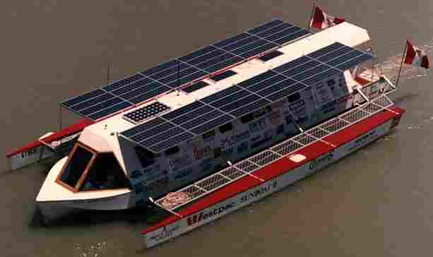
http://www.telemark.... ... 402_tofino


My "thinking outside the box" award of all time has to go to architect Chris Gower for his submission to the 2020 poster board display, where architects were asked to use their imaginations to come up with an ideas for what Victoria's future might hold. I emailed him and he was kind enough to give me permission to post pictures of the board.

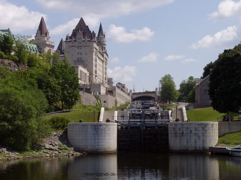
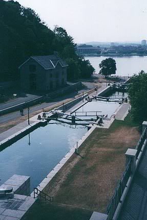
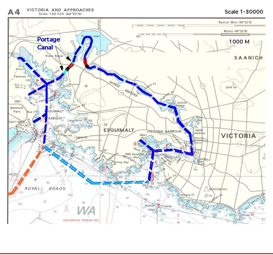
His submission was called "The case for portage canal" and showed how with a couple of canals we could create a waterway transit and commuter route which nicely connects the Western Communities, Esquimalt and Burnside, James Bay, and Downtown. I loved it.
Here is a detail of one of the panels - The full panel images can be found at http://www.flickr.co... ... 006031892/ . The red and black bits are culverts or channels, with locks to control tidal flow.

Chris Gower, architect for Downtown Victoria 2020
[/url:fcd9b]

Here is a google close up of where the canal would go through into Esquimalt Harbour:
[url="http://maps.google.com/?ie=UTF8&om=1&z=15&ll=48.450439,-123.43101&spn=0.019213,0.041027&t=h"]http://maps.google.com/?ie=UTF8&om=1&z= ... 041027&t=h
Nowadays most people die of a sort of creeping common sense, and discover when it is too late that the only things one never regrets are one's mistakes.
Oscar Wilde (1854 - 1900), The Picture of Dorian Gray, 1891

#2 ressen

ressen
  • Member
  • 539 posts

Posted 18 March 2007 - 09:14 AM

It would not take much of a blustery day to make the outside passage rough and uncomfortable. Would all passengers be required to don survival suites for the trip? Portage Canal for use by canoes is an excellent idea. It might be cheaper though to build an aqueduct. Public transit by water is used in many cities around the world and should be used in Sooke Harbour, Esquimalt Harbour, Victoria Harbour and Saanich Inlet in conjunction with other transit modes.

#3 Caramia

Caramia
  • Member
  • 3,835 posts

Posted 18 March 2007 - 09:46 AM

Yeah I believe the plan called for the dark blue area to be the commuter route channeling traffic into the inner passage, which hooks into the outside light blue and orange heavier navigation routes. On rough days the lock system would control the flow. There were more details in the text of the poster boards I linked, but they are sort of low rez for reading. I apologise for that.

Oh if anyone here knows anything about locks and how they actually work I would love to hear, I am not sure I understand that bit entirely.

Also, any other good examples of marine commuting?
Nowadays most people die of a sort of creeping common sense, and discover when it is too late that the only things one never regrets are one's mistakes.
Oscar Wilde (1854 - 1900), The Picture of Dorian Gray, 1891

#4 Holden West

Holden West

    Va va voom!

  • Member
  • 9,058 posts

Posted 18 March 2007 - 10:56 AM

I think any attempt to build a canal or lock system in Victoria would make the environmental crowd flip out.

The most famous marine commuting system is Venice Italy's [url=http://www.venicewelcome.com/actv/vaporetto.htm:4efda]Vaporetto[/url:4efda]. It works like a subway, even the complex but easy to follow [url=http://www.cafeytren.com/mapas/mapas/ciudades/venecia_vaporetto.jpg:4efda]maps[/url:4efda] are done subway-style. Gondolas are strictly for tourists and water taxis for the rich.

Seeing the operators tie up a forty-foot boat snug against a dock in choppy seas in six seconds flat is a work of art.


"Beaver, ahoy!""The bridge is like a magnet, attracting both pedestrians and over 30,000 vehicles daily who enjoy the views of Victoria's harbour. The skyline may change, but "Big Blue" as some call it, will always be there."
-City of Victoria website, 2009

#5 Caramia

Caramia
  • Member
  • 3,835 posts

Posted 18 March 2007 - 12:51 PM

Great pictures! Just look at those setbacks...
:-D
Nowadays most people die of a sort of creeping common sense, and discover when it is too late that the only things one never regrets are one's mistakes.
Oscar Wilde (1854 - 1900), The Picture of Dorian Gray, 1891

#6 Icebergalley

Icebergalley
  • Member
  • 596 posts

Posted 18 March 2007 - 02:05 PM

Holden West wrote:

Seeing the operators tie up a forty-foot boat snug against a dock in choppy seas in six seconds flat is a work of art.


The big outriggers you may have seen on the Gorge and in the Harbour are 45 feet long...

I understand the challange...


I think any attempt to build a canal or lock system in Victoria would make the environmental crowd flip out.


What kind of problems do you anticipate?

#7 gumgum

gumgum
  • Member
  • 7,069 posts

Posted 18 March 2007 - 02:12 PM

Locks are a nautical version of an elevator where boats enter a large reservoir which is enclosed by giant doors.
If for example a boat is heading down-river, the reservoir would let out water slowly until the surface level is equal to the level in the level ahead. You can see one to a dozen in a series, depending on how steep the slope is.
Trouble with them is that is is extremely time consuming. Integrating a lock system into a water transit system wouldn't work unless is was maybe just one lock.
Check out Ottawa's Rideau Canal, which has a many locks.


#8 Caramia

Caramia
  • Member
  • 3,835 posts

Posted 18 March 2007 - 02:58 PM

Thanks gumgum! Pretty simple when you explain it that way.

Looks like two locks in Chris's plan, mind you, we weren't expecting anyone to do any consulting or background research - it was a casual brainstorming.

About how long do locks take to get through usually?
Nowadays most people die of a sort of creeping common sense, and discover when it is too late that the only things one never regrets are one's mistakes.
Oscar Wilde (1854 - 1900), The Picture of Dorian Gray, 1891

#9 Holden West

Holden West

    Va va voom!

  • Member
  • 9,058 posts

Posted 18 March 2007 - 03:10 PM

Paris has a lock system on the St. Martin canal although it's mainly for pleasure boats. It's nice to walk along.


"Beaver, ahoy!""The bridge is like a magnet, attracting both pedestrians and over 30,000 vehicles daily who enjoy the views of Victoria's harbour. The skyline may change, but "Big Blue" as some call it, will always be there."
-City of Victoria website, 2009

#10 gumgum

gumgum
  • Member
  • 7,069 posts

Posted 18 March 2007 - 08:06 PM

About how long do locks take to get through usually?


Well the average time it takes to fill (or empty) a lock on the Rideau System (in Ottawa and Eastern Ontario) takes about 5 minutes. So for 2 locks it would take 10 minutes. Not as long as I thought it was actually.

#11 gumgum

gumgum
  • Member
  • 7,069 posts

Posted 18 March 2007 - 10:13 PM

the surface level is equal to the level in the level ahead

Great writing skills, gumgum.

#12 rayne_k

rayne_k
  • Member
  • 170 posts

Posted 18 March 2007 - 10:43 PM

I love vaporettos.. it was exactly what came to mind when I mentioned BC transit getting in the water... I think even a network from the Tillicum area, and Esquimalt areas into downtown with a few stops here and there (with transit connections) would be a great improvement - of course it might cut into the harbour ferries busines, but the needs of local commuters are more important.

As for the for the outer area, maybe there is some sort of operational work around - not BC transit running them or something, and rough seas - well then it's not for those who get motion sickness - they can take the bus or drive. The rest of us that enjoy rollicking rides can take the outer-route. :)

I have some more to say (on riparian protection), but I'm about to do a face plant into my keyboard.. good night all.

#13 G-Man

G-Man

    Senior Case Officer

  • Moderator
  • 13,805 posts

Posted 19 March 2007 - 10:02 AM

I think you could set up an excellent Vaporetto service along the Gorge. I think that anything outside of the harbour may be too costly at the outset. I am wondering if this was ever a considered option for local rapid transit?

The stops as I see them could be.

Vic General - Near the Helmeken Overpass, There is even room for a park and ride here.

Admirals Walk - Near the motel site.

Tillicum - On the Gorge Road side at Gorge Park.

Selkirk - Though one would to be careful not to upset the rowing operations.

Lower Johnson Near the new location for the harbour ferries.

Ships Point - This would be the main station located right at Ships point.

At this point they would go back along the same routing

A second line would run:

Ships Point

Belleville Terminal at the end of the new terminal near the current clipper terminal.

Fisherman's Wharf - Possibly near the current fuel station

Ogden Point - Summer only for cruise ship passengers, also a summer only routing would avoid most bad weather.

West Bay Marina - For the Esquimalt commuters

Songhees - Should be closer to OPR.

Lower Johnson

Then back to Ships Point.

Visit my blog at: https://www.sidewalkingvictoria.com 


It has a whole new look!


#14 rayne_k

rayne_k
  • Member
  • 170 posts

Posted 19 March 2007 - 05:41 PM

I think you could set up an excellent Vaporetto service along the Gorge. I think that anything outside of the harbour may be too costly at the outset. I am wondering if this was ever a considered option for local rapid transit?

The stops as I see them could be.

Vic General - Near the Helmeken Overpass, There is even room for a park and ride here.

Admirals Walk - Near the motel site.

Tillicum - On the Gorge Road side at Gorge Park.

Selkirk - Though one would to be careful not to upset the rowing operations.

Lower Johnson Near the new location for the harbour ferries.

Ships Point - This would be the main station located right at Ships point.

At this point they would go back along the same routing

A second line would run:

Ships Point

Belleville Terminal at the end of the new terminal near the current clipper terminal.

Fisherman's Wharf - Possibly near the current fuel station

Ogden Point - Summer only for cruise ship passengers, also a summer only routing would avoid most bad weather.

West Bay Marina - For the Esquimalt commuters

Songhees - Should be closer to OPR.

Lower Johnson

Then back to Ships Point.


Sounds good - the motel site would be ideal. There could be a little town centre and some high density housing on that side across from the parkway& beach some express routes out to the westshore... it could even be solar powered, or a solar hybrid.


I'm not in favour of any cut throughs at Thetis Cove for canals or anything.. this region is part of the pacific flyway and I think it is importatnt to retain riparian habitat where still exisits, and try to tempt people into living closer to town anyhow rather than providing mediocre service to far flung places.

The other idea I had, was that there should more places for public moorage & storage of small craft near the Gorge and access points to get to the water from. I'd love to see more people actively canoeing and kayaking along there. imho any new developments within a block of a water access point should have kayak & canoe storage (like bike storage). Spaces that aren't used by residents can be leased to others.


#15 Icebergalley

Icebergalley
  • Member
  • 596 posts

Posted 19 March 2007 - 08:44 PM

When will someone do the business plan to use the already constructed pier at the Railyards to achieve the above vision of neighbourhood convenient kayak storage on the Gorge?


The above picture arrived after I saw the message.. and I chuckled...

On a year round basis, the Gorge Waterway in addition to the industrial users has so many self powered watercraft that perhaps we should have a field trip along the Gorge so that Vibrant Victoria doesn't get misrepresented...

#16 Caramia

Caramia
  • Member
  • 3,835 posts

Posted 19 March 2007 - 09:24 PM

I did email Chris Gower with a link to this site, he replied with a great write-up explaining the technical aspects of the idea further, including some of its limitations, as well as its potential. Some of this was included in the poster board I linked but it was hard to read. Many thanks to Chris for being so accomodating in dredging up this stuff for us and for letting us kick around this idea a bit.

Now, if I can just get him to register...
:twisted:

The necessary technical tricks would be as follows:

1. A sizeable concrete culvert containing the +/- 10 meter wide canal
would be necessary to be dug under the rising slope of the old island
highway , east of the railway overpass, and then continuing under the
E&N railway embankment. Only a portion of the canal would be in the
open at the Esquimalt Harbour side of Portage Park. Little of the park
would need to be affected.

2. Dedged channels would be necessary both in Esquimalt Harbour and in
Portage Basin, leading east to Craigflower Bridge. Depending on boat
drafts, some lesser dredging would likely be needed in the Gorge.

3. Two locks would be included on each side of Portage Basin , to
control the rate of higher tidal flows, and to prevent low water tides
from draining the Basin : one at the Portage Park Culvert end, and one
at the Craigflower Bridge end (advisably and most cheaply a component
of the upcoming replacement Craigflower Bridge). Such simple locks have
been used extensively in European canal, river, and tidal waterways for
over two centuries. These locks might even be self powered through the
use of tidal currents. The two sets of locks and channels are shown on
the canal plan,

4. The maximum difference in tidal water level between the ocean and
Portage Inlet is reported as less than two feet, even for extreme
tides. The time for water levels to equalize in a lock system with this
small tidal variance would likely be less than five minutes, depending
on the lock volume. In many tidal conditions (between 1/3 and 1/2 of
the monthly tidal calender) water level differences would make use of
the locks mostly unnecessary. Weirs on each side of the Craigflower
lock and channel would allow tide flows and fish to pass through in the
same manner as at present, at all times.

5. If two canal water-buses with a capacity of 50 persons each (a city
bus), total 100 passengers, fitted into each lock and cleared each lock
in under 5 minutes, then 60 minutes divided by 5 minutes (12 lock
passages) times 100 seats would equal 1200 passengers passing through
the system in a rush hour (this assumes each of the two locks being
filled with two boats simultaneously , with timing of the pairs of
boats to arrive at each lock at the same time). So a potential three
hour staggered commuter flow could be about 3600 persons each morning
and evening. This is not a huge transit flow, but would add up to a
possible 1800 less cars on the Colwood Highway in each of the two rush
hours, with much less resulting pollution, operating cost, aggravation,
and parking pressures Downtown. I bet that the canal and lock system
could cost much less than adding new vehicle lanes to the Colwood
highway.

In Europe the many canal systems are remarkably environmentally
friendly - clean, full of fish, very cost efficient in terms of
transportation, and very quietly enjoyable for thousands of
vacationers.

Portage Canal would not be solely a transit amenity. The bonus benefits
would be for boat tours, excursion and recreation. The outer ring in
the open water south of the city indicates a circle route which would
be used in clement weather conditions only.

Cost to initially develop Portage Canal is indeed a hurdle, but once in
place the system could serve generations of Victorians with minimal
maintenance, and maximum enjoyment.


Nowadays most people die of a sort of creeping common sense, and discover when it is too late that the only things one never regrets are one's mistakes.
Oscar Wilde (1854 - 1900), The Picture of Dorian Gray, 1891

#17 VicHockeyFan

VicHockeyFan
  • Suspended User
  • 52,121 posts

Posted 19 March 2007 - 09:46 PM

Hmm, I did not know locks would be required.
<p><span style="font-size:12px;"><em><span style="color:rgb(40,40,40);font-family:helvetica, arial, sans-serif;">"I don’t need a middle person in my pizza slice transaction" <strong>- zoomer, April 17, 2018</strong></span></em></span>

#18 Barra

Barra
  • Member
  • 592 posts

Posted 20 March 2007 - 12:08 AM

@icebergalley-

Anytime you want a tour of the Gorge for the vibrant folks, you can arrange a dragonboat trip through Ocean River Sports or the Gorge Rowing club. I have done dragonboating for 9 years and just love it - and the view of the Gorge from the water is sublime.

(actually, iceberg, when you mentioned 45 ft outriggers, I think you were talking about dragonboats...)
Pieta VanDyke

#19 Holden West

Holden West

    Va va voom!

  • Member
  • 9,058 posts

Posted 20 March 2007 - 08:01 AM

Hmm...all the Vibrant Victorians out on the open water in an unstable boat?


:-D
"Beaver, ahoy!""The bridge is like a magnet, attracting both pedestrians and over 30,000 vehicles daily who enjoy the views of Victoria's harbour. The skyline may change, but "Big Blue" as some call it, will always be there."
-City of Victoria website, 2009

#20 Icebergalley

Icebergalley
  • Member
  • 596 posts

Posted 20 March 2007 - 08:19 AM

@icebergalley-

Anytime you want a tour of the Gorge for the vibrant folks, you can arrange a dragonboat trip through Ocean River Sports or the Gorge Rowing club. I have done dragonboating for 9 years and just love it - and the view of the Gorge from the water is sublime


(actually, iceberg, when you mentioned 45 ft outriggers, I think you were talking about dragonboats...)


We'll have to do a dragon boat tour on a fine day.. maybe even get Dennis Mintey? to give us his tour.. Do you steer? I just paddle..

BTW.. here's the spec on the OC-6 that I paddle and steer .. Lootass meets these spec's but Tillikum is heavier...

MIRAGE - OC-6

This winning six-man outrigger canoe is fast! The Mirage surfs with ease and has an outstanding record of victories in nearly all of the major outrigger races in recent years. Paddling clubs have taken note and the Mirage is now the boat of choice for the world's best outrigger teams. The Mirage most recently won first, second and third in the famous Molokai Hoe Race in 2001.

The Mirage's unique hull was designed along the same concept as America's Cup yachts. The hull's rocker is different than anything out there; it begins as a smooth curve at the bow and straightens out towards the stern. This shape allows the boat to stay horizontal in most ocean conditions and surfing is made easier by sliding down forward of the swells and waves.

The details and quality of the construction of the Mirage are superb. Built with the best possible composite materials, the Mirage conforms to HCRA and KOA specifications. A special foam core vacuum bagged laminate is available on custom order and weighs in at 265-290 lbs. The integrated canvas/spray deck track is laminated into the side of the boat creating a clean and easy to use system.

The Mirage - the boat of choice!

Over all length: 45'
Loaded waterline length: 37' 8"
Standard weight HRCA specs: 385 - 400 lbs
Foam core vacuum bagged laminate: 265-290 lbs

You're not quite at the end of this discussion topic!

Use the page links at the lower-left to go to the next page to read additional posts.


0 user(s) are reading this topic

0 members, 0 guests, 0 anonymous users