Faulty vehicle is still a tiny amount of crash responsibility though, it's still mostly driver error.
Well, defective equipment did kill three on the 'Hat in 2012.
http://www.timescolo...crash-1.1193367

Resident Housekeeper

Posted 25 October 2017 - 06:01 PM
Faulty vehicle is still a tiny amount of crash responsibility though, it's still mostly driver error.
Well, defective equipment did kill three on the 'Hat in 2012.
http://www.timescolo...crash-1.1193367
Victoria current weather by neighbourhood: Victoria school-based weather station network
Victoria webcams: Big Wave Dave Webcams
GET OFF MY LAWN

Posted 25 October 2017 - 06:07 PM

Posted 25 October 2017 - 07:02 PM
^ Yup I remember outfitting my 1979 1/2 Mustang with some awesome bias ply rear snow tires from Woolco, I think they were $29!!!

Posted 01 November 2017 - 02:35 PM
M+S meets the winter tire requirements for the Malahat.
It's my opinion that they're generally rubbish and the requirement should be for the mountain snowflake symbol.
Both the mountain snowflake and M+S tires meet the minimum requirement for winter tires in BC.
The Ministry of Transportation and Infrastructure and the RCMP recommend that regular travellers on BC’s highways equip their cars and light trucks with the mountain snowflake tire, which is the best tire available for winter conditions.
M+S tires are a viable option for motorists who live in areas without frequent winter weather and who plan their trips to coincide with periods of better weather.
More; https://www2.gov.bc....nbc_handout.pdf
Posted 10 November 2017 - 08:06 AM
Looks like the Government is interested in soliciting citizen feedback regarding average speed cameras on the Malahat. Lets hope its because they realise there is an agenda behind this and it will have minimal effect on safety and listen....more to follow when contact info available

Posted 11 November 2017 - 07:56 AM
Know it all.
Citified.ca is Victoria's most comprehensive research resource for new-build homes and commercial spaces.
Resident Housekeeper
Posted 11 November 2017 - 09:15 AM
If it was anything like the 60 zone at TCH&McKenzie, that's not the sort of compliance or flow we should be looking for.
Victoria current weather by neighbourhood: Victoria school-based weather station network
Victoria webcams: Big Wave Dave Webcams
Posted 11 November 2017 - 10:41 AM
Know it all.
Citified.ca is Victoria's most comprehensive research resource for new-build homes and commercial spaces.

Posted 11 November 2017 - 04:30 PM
I did like the 60 zone when towing my RV. Not that I can't do 80 up all the hills on the malahat but even if you do the speed limit people are desperate to pass rvs.
Posted 19 December 2017 - 10:28 AM
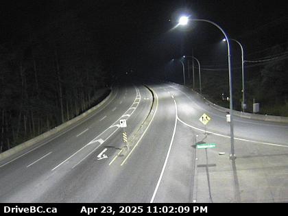
At South Shawnigan Lake Road looking south.
Senior Case Officer
Posted 30 December 2017 - 10:18 PM

Posted 31 December 2017 - 07:55 AM

Posted 31 December 2017 - 09:44 AM
I'm all for re-opening the Burnt Bridge route, and I think it's a shame that it's been closed as long as it's been closed. We can all thank TimberWest for that (and for keeping the rest of the South Island backwoods locked up tight as well).
But IMO, the Burnt Bridge is a scenic route only.
A bridge or twinned Malahat will never happen of course (as we've previously discussed), which leaves my previously presented ideal solution  as a new, Swartz Bay to Cowichan Bay ferry, which at around 7 miles would be roughly a half hour trip from dock to dock.
With the half hour drive up the Pat Bay Highway, that makes Victoria to Duncan about one hour and 15 minutes, not including ferry wait times.
WIN/WIN for everybody in that road construction is minimal, and the dockage is already in place at Swartz Bay, with only the Cowichan Bay terminal needing to be constructed. AND - if you made the ferry scalable, you could up the capacity on reasonably short notice, such as those times when the Malahat is closed due to an accident, or the inclement weather hazard is high (for South Island drivers, anything resembling snow).
All kidding aside, unless you're going to commit to a six lane super-highway from Langford to Mill Bay, and build it up through (or near) the watershed lands, you can forget about a roadway solution to the Malahat. A roadway solution looks like the "new" Island Highway where it splits off at Nanaimo and continues up-island. THAT'S what the roadway solution looks like - a six lane expressway ... and that will never happen IMO, as the watershed is now and forever locked up as if it were a maximum security prison facility.
But for practical purposes, we live on an island surrounded by a bunch of smaller islands, and we're already very well served by a wide variety of ferry routes ... the "Malahat Solution" is (IMO) simply a *new* ferry solution?
Edited by Cassidy, 31 December 2017 - 09:45 AM.
Senior Case Officer
Posted 31 December 2017 - 10:06 AM
Posted 31 December 2017 - 10:08 AM
Posted 31 December 2017 - 10:25 AM
I wasn't saying that it would be a day to day alternative but rather a faster secondary route then the current circle route through Lake Cowichan for when the Malahat is closed.
The Pacific Marine Route up thorough Cowichan is a very upgraded, recently re-paved bit of roadway. I don't think Burnt Bridge could ever be any faster ... even if paved it's still basically a one lane logging road.
Highways have already dumped a millions into the Pacific Marine Route, and I can't seem them doing the same thing again just a few miles to the south.
In reality though, neither Burnt Bridge or Pacific Marine are in any way effective detours for the Malahat, as for much of the winter, these areas are covered in snow, and are (despite improvements) a looooonnnng way out in the bush, such that any normal family of four might be a bit nuts to try such a detour in the middle of winter, over a pitch black bit of roadway with ZERO services, and nothing even close to regular RCMP patrols.
It's risky business to head up into the south island mountains in winter, this on what is ultimately just a logging road, be it paved or unpaved. (recall that guy a few years ago that got stuck in the snow up on the Pacific Marine Route, inspiring a large scale search, eventually found after a couple of days, "OK", but highlighting that this route simply isn't safe in winter).
Posted 31 December 2017 - 10:30 AM
I’m sure we can find a way to build a road through a watershed. You put a ditch / pipe on each side to collects any troublesome runoff.
In my experience, aside from the fact that they (the CRD) simply don't want you anywhere near the watershed, their biggest concern is always fire, not pollution.
Watershed security is obsessed with fire, or anything at all that might start a fire.

Posted 31 December 2017 - 09:08 PM
With all of the water being shedded, I would think that the risk of fire would be rather low. 
Posted 31 December 2017 - 10:49 PM
I wasn't saying that it would be a day to day alternative but rather a faster secondary route then the current circle route through Lake Cowichan for when the Malahat is closed.
And far far away from those pesky sidewalks.
Posted 01 January 2018 - 05:46 PM


0 members, 0 guests, 0 anonymous users

Community Forum Software by IP.Board 3.4.6
Licensed to: Citified Media Inc. All materials © Copyright Citified Media Inc. All rights reserved.
