The Malahat railway bed gets straightened and paved for two south-bound lanes from just north of Tunnel Hill.
The general number of 25,000 cars per day is used to describe traffic on the Malahat.
Splitting into two routes let's use 12,000 cars per day transiting each direction.
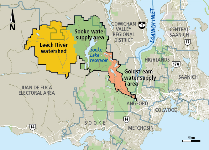
If you honestly believe that the CRD will allow 12,000 cars to transit to the west of Japan Gulch, then such a plan might be conceivable.
I don't believe for a second that the CRD would allow cars anywhere near Japan Gulch ... ever! ... definitely not between the reservoir and Japan Gulch itself.
This same kind of "caution" exercised by the CRD is also what nukes the repurposing of the Niagra Mainline route ... they're just never going to let traffic that close to the watershed.
Repurposed logging roads or rail routes are interesting ... but the solution to this problem remains a bridge first, and a very specific and well designed ferry operation second.
Either way, the workable solutions utilize the Saanich Peninsula as a launch point, and ignore any expansion of the existing road route from Goldstream heading north.
Edited by Spy Black, 11 December 2021 - 07:30 AM.